
In the latest installment of the Anecdotally Speaking podcast, hosts Mark and Shawn examine the profound intersection of ancient maritime tradition and modern organizational leadership. Episode 282, titled after the remarkable history of Polynesian wayfinding, delves into the 1976 voyage of the Hōkūleʻa—a traditional double-hulled voyaging canoe—and the cultural revival that followed. The episode highlights how the nearly lost art of non-instrument navigation offers critical insights into strategic alignment, the necessity of a clear corporate vision, and the nuances of high-stakes knowledge transfer. By revisiting the moment a master navigator challenged his apprentice to "see" a destination that was not yet visible, the discussion provides a framework for leaders who must guide their organizations through the metaphorical open oceans of the modern market.
The Historical Context of Polynesian Wayfinding
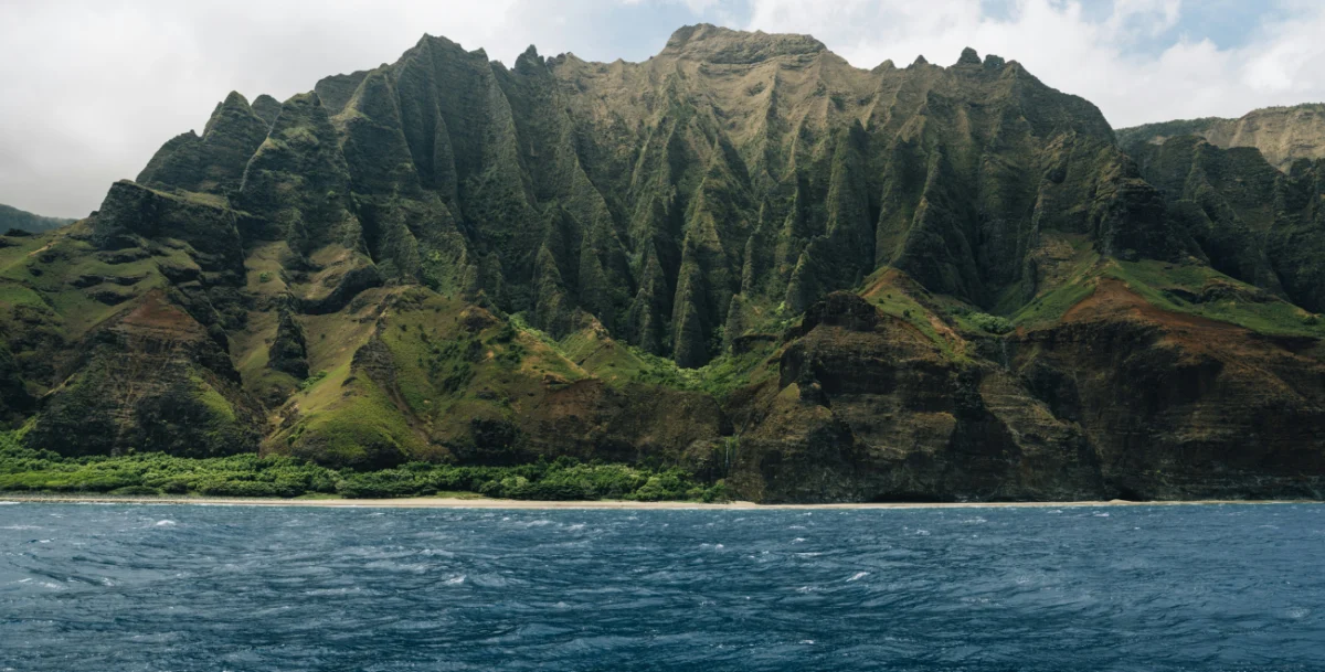
For over three millennia, Polynesian voyagers inhabited and navigated the vast "Polynesian Triangle," an area of the Pacific Ocean spanning roughly 10 million square miles, with corners at Hawaii, Easter Island (Rapa Nui), and New Zealand (Aotearoa). These mariners achieved what many Western historians once considered impossible: the intentional discovery and settlement of remote islands without the use of metal tools, compasses, or written charts.
When Captain James Cook first entered the Pacific in the late 18th century, he was equipped with the most advanced technology of the Enlightenment, including sextants and early marine chronometers. Cook was famously perplexed by the presence of indigenous peoples on islands separated by thousands of miles of open water. While Cook himself recognized the skill of these navigators, later Western scholars in the 19th and early 20th centuries often dismissed Polynesian achievements. A prominent theory, popularized by New Zealand historian Andrew Sharp in the 1950s, suggested that the islands had been settled by "accidental drift"—the idea that fishing parties had been blown off course and stumbled upon new lands by sheer luck. This perspective stripped the Polynesian ancestors of their agency and intellectual legacy, suggesting they were victims of the ocean rather than its masters.
The 1970s Cultural Renaissance and the Birth of the Hōkūleʻa
By the mid-20th century, the traditional art of wayfinding had almost entirely vanished from the Hawaiian Islands. The pressures of colonization, the introduction of Western education, and the reliance on modern technology had rendered ancient celestial navigation techniques obsolete. However, the 1970s sparked a "Hawaiian Renaissance," a period of renewed interest in indigenous culture, language, and history.
In 1973, the Polynesian Voyaging Society (PVS) was founded by nautical historian Herb Kawainui Kāne, sociologist Ben Finney, and sailor Charles Tommy Holmes. Their objective was twofold: to prove that ancient Polynesians could have purposely navigated across the Pacific and to revitalize the pride of the Hawaiian people. To achieve this, they commissioned the construction of the Hōkūleʻa, a 62-foot-long performance-accurate replica of an ancient voyaging canoe.
The ultimate test for the Hōkūleʻa was a 2,500-mile journey from Hawaii to Tahiti. However, the PVS faced a significant obstacle: no living Hawaiian possessed the knowledge required to navigate such a distance without instruments. The search for a teacher led them to the tiny island of Satawal in Micronesia, where a master navigator named Mau Piailug remained one of the few individuals on Earth who still practiced the ancient "Way of the Navigator."

The Master and the Apprentice: A Study in Knowledge Transfer
Mau Piailug’s decision to teach the Hawaiians was controversial within his own culture, as wayfinding was a sacred, guarded secret. However, Mau recognized that the tradition was dying and believed that by sharing it with the Hawaiians, he could ensure its survival for future generations. His primary student was Nainoa Thompson, a young Hawaiian who would eventually become the first Hawaiian in centuries to practice wayfinding.
The training was rigorous and relied entirely on sensory observation and mental models. Wayfinding involves "reading" the environment through hundreds of daily observations:
- Celestial Navigation: Tracking the rising and setting points of stars (the Star Compass).
- Ocean Swells: Feeling the direction and strength of deep-sea swells that persist even when the wind changes.
- Bio-indicators: Observing the flight patterns of birds like the White Tern (Manu-o-Kū), which fly out to sea to fish in the morning and return to land at night.
- Atmospheric Signs: Analyzing the color of clouds (which can reflect the green of a hidden lagoon) and the smell of the air.
The Anecdotally Speaking podcast focuses on a pivotal exchange between Mau and Nainoa during this training period. While standing on a beach, Mau asked Nainoa, "Can you see Tahiti?" When Nainoa admitted he could not see it with his eyes, Mau explained that the physical sight was secondary to the mental image. He stated, "If you can’t see the island in your mind, you are lost."
The 1976 Voyage and Global Impact
On May 1, 1976, the Hōkūleʻa departed from Honolua Bay, Maui, bound for Tahiti. Mau Piailug served as the navigator, using only his senses to guide the vessel. The journey took 31 days. When the Hōkūleʻa arrived in Papeete, Tahiti, it was met by an estimated 20,000 people—nearly half the population of the island at the time. The successful voyage effectively debunked the "accidental drift" theory and served as a catalyst for a surge in cultural identity across the Pacific.
In the decades since, Nainoa Thompson and a new generation of navigators have completed dozens of voyages, including a multi-year "Malama Honua" worldwide voyage that covered over 40,000 nautical miles. Today, while these vessels carry modern safety equipment and GPS in sealed containers for emergencies, the navigation itself remains strictly traditional.
Leadership Analysis: The "See Tahiti" Principle
In the context of organizational strategy, the story of the Hōkūleʻa serves as a powerful metaphor for leadership and alignment. Mark and Shawn argue that many corporate failures stem not from a lack of "tools" (GPS, data, software), but from a lack of a vivid, shared mental picture of the destination.
1. Strategic Clarity and Visualization
In modern business, "Tahiti" represents the strategic goal or the five-year vision. Leaders often provide their teams with spreadsheets and KPIs, which are the equivalent of coordinates. However, coordinates do not inspire or guide a team through "storms" or periods of uncertainty. The "See Tahiti" principle suggests that a leader’s primary job is to hold the vision so clearly in their own mind—and communicate it so vividly—that the team can "see" it even when it is thousands of miles over the horizon.

2. Navigating Without a "Map"
The business world is increasingly characterized by "VUCA" (Volatility, Uncertainty, Complexity, and Ambiguity). Like a navigator in the middle of the Pacific, a CEO cannot always rely on historical data (the map) because the environment is constantly shifting. Wayfinding requires a leader to stay "present," making hundreds of small course corrections based on real-time feedback from the market, rather than blindly following a pre-set plan.
3. Cultural Alignment and Succession
The transfer of knowledge from Mau to Nainoa illustrates the importance of mentorship and the preservation of "tacit knowledge." In organizations, the most valuable insights are often not found in manuals but in the intuition and experience of veteran employees. The Hōkūleʻa story emphasizes that for an organization to survive long-term, it must prioritize the intentional passing of "the way" to the next generation of leaders.
Broader Implications for Organizational Culture
The Anecdotally Speaking podcast highlights how storytelling is the primary vehicle for this kind of alignment. By sharing the story of the Hōkūleʻa, leaders can move beyond dry strategy presentations and tap into a narrative that emphasizes resilience, heritage, and collective purpose.
Data from Anecdote International suggests that when strategy is communicated through narrative rather than just data, retention and engagement levels among employees increase significantly. In an era where "quiet quitting" and organizational silos are common, the Hōkūleʻa narrative offers a model for unity. Every person on the canoe had a specific role—tending the sails, bailing water, or preparing food—but every role was predicated on the navigator’s ability to "see the island."
Conclusion: The Enduring Legacy of the Wayfinder
The voyage of the Hōkūleʻa was more than a maritime feat; it was a demonstration of the power of human vision and the importance of ancestral wisdom in a technological age. For the business community, the lessons are clear: technology is a tool, but it is not a substitute for leadership.
As organizations prepare for their next "voyage"—whether it be a digital transformation, a market expansion, or a cultural shift—leaders must ask themselves the same question Mau Piailug asked Nainoa Thompson: "Can you see Tahiti?" If the destination is not clear in the leader’s mind, the most advanced "GPS" in the world will not prevent the organization from drifting. By fostering a culture of wayfinding, where every member of the team understands the signs and remains focused on the distant horizon, modern enterprises can navigate even the most turbulent waters with confidence and purpose.
