
The intersection of ancient maritime wisdom and modern organizational leadership serves as the focal point of the latest analysis from Anecdote International, as presented in episode 282 of the Anecdotally Speaking podcast. In a detailed exploration of Polynesian wayfinding, hosts Mark and Shawn examine how the historical revival of traditional navigation techniques offers a profound metaphor for strategic alignment, vision, and the preservation of institutional knowledge. The central narrative focuses on the 1976 voyage of the Hōkūleʻa, a traditional double-hulled canoe that sailed from Hawaii to Tahiti without the aid of modern instruments, proving that success in complex environments depends less on technological tools and more on the leader’s ability to maintain a vivid mental image of the destination.
The Historical Context of Polynesian Wayfinding
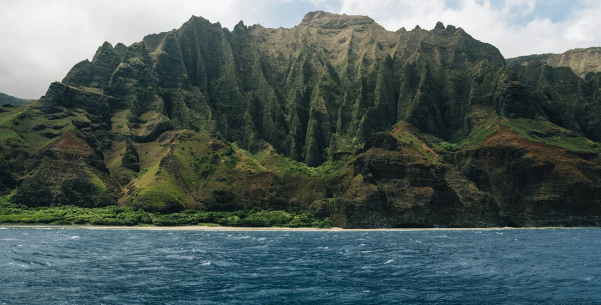
For over three millennia, Polynesian navigators traversed the "Polynesian Triangle"—a vast expanse of the Pacific Ocean covering approximately 10 million square miles, anchored by Hawaii to the north, Easter Island (Rapa Nui) to the southeast, and New Zealand (Aotearoa) to the southwest. These voyagers utilized a sophisticated system of "wayfinding," a method of non-instrument navigation that relied on an intimate understanding of the natural world.
When Captain James Cook first entered the Pacific in the late 18th century, he was equipped with the most advanced European technology of the era, including sextants and marine chronometers. Cook was reportedly astonished to find indigenous populations inhabiting remote islands separated by thousands of miles of open ocean. While Cook recognized the maritime prowess of the Polynesians, later Western scholars in the 19th and early 20th centuries grew skeptical. By the mid-20th century, theories such as those proposed by New Zealand historian Andrew Sharp in 1956 suggested that the settlement of the Pacific was the result of "accidental drift" rather than purposeful navigation. Sharp argued that it was mathematically impossible for humans to navigate long distances accurately without instruments.
This skepticism created a cultural vacuum in Hawaii, where traditional voyaging knowledge had nearly vanished by the 1970s due to the influence of Western colonization and the adoption of modern maritime technology. The art of wayfinding was on the brink of extinction, preserved only in a few remote corners of Micronesia.
The Founding of the Polynesian Voyaging Society
In 1973, a group of visionaries—nautical historian Ben Finney, artist Herb Kawainui Kāne, and sailor Tommy Holmes—founded the Polynesian Voyaging Society (PVS). Their objective was twofold: to debunk the "accidental drift" theory and to reclaim Hawaiian cultural identity. To achieve this, they commissioned the construction of the Hōkūleʻa ("Star of Gladness"), a 62-foot-long performance-accurate replica of an ancient voyaging canoe.
However, the PVS faced a critical challenge: no living Hawaiian possessed the knowledge required to navigate the 2,500-mile journey from Hawaii to Tahiti using only traditional methods. The search for a master navigator led them to the small island of Satawal in Micronesia, where Mau Piailug, a master of the ancient "Pwo" tradition of navigation, agreed to share his sacred knowledge.
The Apprenticeship of Nainoa Thompson
The transfer of knowledge from Mau Piailug to a young Hawaiian named Nainoa Thompson became the catalyst for the modern revival of wayfinding. Mau’s teaching method was rigorous and relied entirely on sensory observation and memory. He taught Thompson to read the "star compass," a mental map of 32 points where specific stars rise and set on the horizon.

Beyond the stars, wayfinding required the interpretation of ocean swells. A navigator must distinguish between "dead" swells caused by distant storms and "live" swells caused by local winds. By feeling the motion of the canoe, a navigator can maintain a heading even under total cloud cover. Furthermore, the behavior of "land-finding" birds, such as the white tern (manu-o-Kū), which flies out to sea to fish in the morning and returns to land at night, provided crucial clues for landfalls.
The defining moment of Thompson’s training occurred on a beach when Mau asked him a deceptiveley simple question: "Can you see Tahiti?"
At that moment, Tahiti was thousands of miles away, well beyond the physical horizon. Thompson replied that he could not see it with his eyes but could "picture it in his mind." Mau’s response became the foundational principle of the movement: "That is the most important thing. If the navigator cannot see the island in his mind, he is lost."
The 1976 Voyage and its Cultural Impact
In May 1976, the Hōkūleʻa departed from Honolua Bay, Maui. The crew faced immense physical and psychological pressure. Navigating without a compass or charts meant that Thompson and Mau had to remain awake for the majority of the 31-day journey, constantly processing hundreds of data points from the wind, waves, and sky.
On June 4, 1976, the Hōkūleʻa successfully reached Papeete, Tahiti. The arrival was met with an unprecedented response; an estimated 20,000 people—more than half the population of Tahiti at the time—gathered on the beach to welcome the vessel. This event is widely credited with sparking the "Hawaiian Renaissance," a resurgence of interest in Hawaiian language, music, and traditional arts.
The success of the voyage provided empirical evidence that ancient Polynesians were deliberate explorers. Since 1976, the Hōkūleʻa has sailed over 140,000 nautical miles, including a three-year "Mālama Honua" worldwide voyage from 2014 to 2017, which visited 150 ports in 18 nations.
A Chronology of the Wayfinding Revival
- 1769-1779: Captain James Cook documents Polynesian maritime skills but questions the extent of their navigational reach.
- 1956: Andrew Sharp publishes Ancient Voyagers in the Pacific, popularized the "accidental drift" theory.
- 1973: The Polynesian Voyaging Society is established in Hawaii.
- 1975: The Hōkūleʻa is launched at Kualoa, Oahu.
- 1976: The first voyage from Hawaii to Tahiti is completed in 31 days using traditional navigation.
- 1980: Nainoa Thompson completes the voyage to Tahiti as the first Hawaiian navigator in centuries to use wayfinding.
- 2007: Mau Piailug inducts five Hawaiians, including Thompson, into the rank of Pwo (Master Navigator), ensuring the lineage of knowledge continues.
- 2014–2017: The Hōkūleʻa completes a circumnavigation of the globe to spread a message of environmental sustainability.
Leadership Analysis: The "Mental Picture" and Strategic Alignment
The story of the Hōkūleʻa offers critical insights for contemporary leadership and organizational strategy. Mark and Shawn of Anecdote International highlight several key parallels:
1. The Necessity of a Vivid Destination
In a corporate context, "seeing Tahiti" is synonymous with a clear strategic vision. Many organizations fail not because they lack resources, but because the leadership has not articulated a vivid mental picture of the desired future state. Without this "mental island," teams become reactive to the "swells" of market volatility and the "winds" of internal politics, eventually losing their orientation.

2. Knowledge Transfer and Mentorship
The relationship between Mau Piailug and Nainoa Thompson illustrates the importance of intentional knowledge preservation. In many modern industries, "tribal knowledge" is lost as senior leaders retire. The wayfinding model suggests that technical skills (reading the stars) are secondary to the mindset (the discipline of observation). Organizations must create structures where experienced "navigators" can pass on the nuance of decision-making to the next generation.
3. Alignment Through Shared Narrative
The 1976 voyage succeeded because every crew member understood the mission’s significance. Alignment is not merely about following instructions; it is about shared belief in the destination. When a leader can help their people "see Tahiti," the team becomes self-correcting. They no longer require constant supervision because they are oriented by the same mental map.
4. Navigating Without "GPS"
In the modern business world, leaders often rely on "instruments"—data analytics, KPIs, and market reports. While valuable, these tools can fail or provide lagging indicators. Wayfinding teaches the value of "leading indicators"—the subtle shifts in the environment that signal a change in direction before the instruments register it. A wayfinding leader remains present and observant, sensing shifts in culture or consumer sentiment in real-time.
Broader Implications for Modern Organizations
The implications of the Hōkūleʻa story extend beyond simple storytelling; they challenge the modern reliance on external validation and technological crutches. In the podcast, the hosts emphasize that the Hōkūleʻa still carries a GPS in a sealed container for emergencies, yet the navigators never open it. This represents a balance between honoring tradition and ensuring safety, but it also underscores a commitment to mastery.
For organizations undergoing digital transformation or structural reorganization, the "Wayfinding Leadership" model suggests that the most resilient teams are those that possess a deep, internalized understanding of their purpose. When external "instruments" (market stability, funding, or specific technology) fail, the organization survives because its leaders have the mental fortitude to keep the "island" in sight.
As businesses navigate the increasingly "foggy" waters of the 21st-century global economy, the ancient wisdom of the Pacific serves as a reminder that the most powerful tool for any leader is not a chart or a compass, but a clear, unwavering vision of the destination. The success of the Hōkūleʻa was not a miracle of luck; it was a triumph of alignment, preparation, and the enduring power of the human mind to see what the eyes cannot.
